
Evidence of Medieval peat cutting
on the downs of the Lizard Peninsula
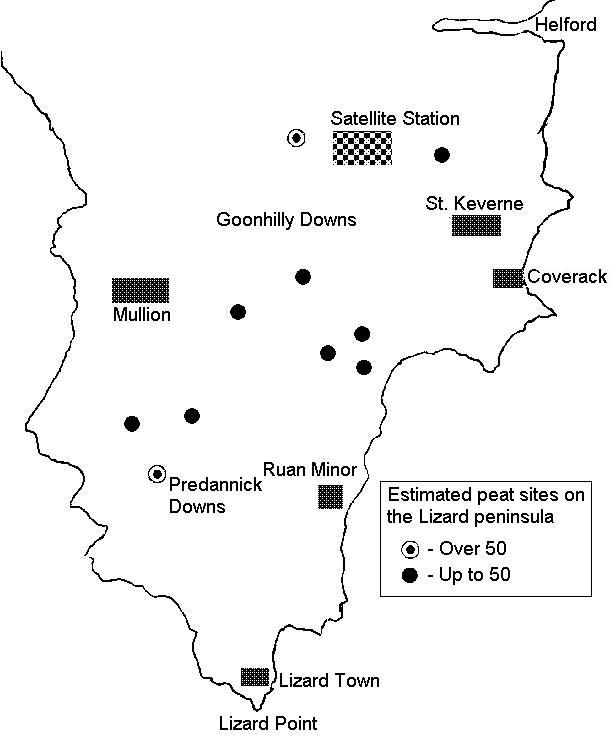
There are over 200 of these features to be seen, in groups or singularly. The largest group known as 54. Though in recent years through lack of management many have become completely overgrown with vegetation.
For many years clusters of these features were recorded on the O.S. maps as prehistoric hut circles, but investigations by archaeologists has never been found that they they were hut circles and recently an alternative has been suggested that they might be peat stacking or peat charcoal burning sites of which there are plenty of records of this in old documents.
Before the use of coal, peat and charcoal were extensively used in the production of tin. For instance in the manorial records of Helston-in-Kerrier of 1359, the sale of peat and charcoal is recorded.
And even more recently many of the older people in the Lizard villages were able to recall the burning of peat in the fire baskets of the cornish ranges (Slabs) and in the grates of the cottages.
Further documentary evidence of the use of peat in the tin mining industry in Cornwall in the medieval period can be seen in a charter granted to the tinners in 1456 by Edward IV, giving the miners of Cornwall the right to cut turf and 'make coals' on Dartmoor, due to the shortage of fuel in their own areas.
Though not totally proven to everyone's satisfaction it is so far the most feasible evidence of the use of these enigmatic structures.